Multimedia Gallery
SnowSTAR 2007 (Image 6)
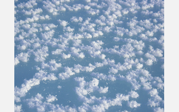
Surface hoar crystals can be seen on the ice of the La Chute River in the Yukan Territory. Measurements of snow and ice were taken from lakes and rivers during the SnowSTAR 2007 expedition. [Image 6 of 7 related images. See Image 7.]
More about this Image
In an expedition led by Matthew Sturm of the U.S. Army's Cold Regions Research and Engineering Laboratory at Fort Wainwright, Alaska, a team of five Americans and three Canadians travelled on snowmobiles from Circle, Alaska, to Baker Lake, Canada, in March and April 2007. The 3000 kilometer trip--called SnowSTAR 2007 (Snow Science Traverse--Alaska Region)--followed the Arctic Circle for much of the route, going through dozens of historic arctic locations, two remote diamond mines and 11 villages, where team members had the opportunity to talk to residents.
The goal of the trip was to find the Arctic; that is, to understand what makes up the modern Arctic and to explore what is changing in both the natural and human systems of this critical region. Along the way, the group had the opportunity to take the first set of comprehensive snow measurements across the Barrenlands, that will be used to determine how best to use satellites to monitor the snow cover of the region.
If scientists can understand the patterns of snow distribution and properties in the current climate, they will be in a much better position to model how this critical element in the Arctic landscape may change along with changes in climate. Scientists can trace the sources of the snow's chemical constituents, such as calcium, magnesium and various isotopes like boron and deuterium, and use the information to pinpoint where the snow originated and its atmospheric history. Snow data can also help show how key meteorological events determine snow characteristics.
A key part of the trip was sharing their experiences and encouraging school kids across the north to share as well. The group brought along posters, photos and greetings from classrooms in the U.S., which they shared with classes in Canada. They also shared their travel experiences more widely via an expedition website and a book (to be published after the trip).
The group also shared their passion for arctic history. Their route was designed to pass through as many historic locations as possible, and they brought enlargements of historic photos with them to share with villagers and place on the website. From the trail, they posted dispatches, pictures and audio clips related to the history and natural systems. The expedition was supported in part by a National Science Foundation Small Grant for Exploratory Research (SGER), awarded by the Office of Polar Programs.
Further information including an interactive map that lets you track the trip as well as read and hear what the team experienced and learned, is available at the SnowSTAR 2007 website Here. [Research supported by National Science Foundation grant ARC 07-00233.] (Date of Image: 2007)
Credit: Matthew Sturm
Images and other media in the National Science Foundation Multimedia Gallery are available for use in print and electronic material by NSF employees, members of the media, university staff, teachers and the general public. All media in the gallery are intended for personal, educational and nonprofit/non-commercial use only.
Images credited to the National Science Foundation, a federal agency, are in the public domain. The images were created by employees of the United States Government as part of their official duties or prepared by contractors as "works for hire" for NSF. You may freely use NSF-credited images and, at your discretion, credit NSF with a "Courtesy: National Science Foundation" notation.
Additional information about general usage can be found in Conditions.
Also Available:
Download the high-resolution JPG version of the image. (9.4 MB)
Use your mouse to right-click (Mac users may need to Ctrl-click) the link above and choose the option that will save the file or target to your computer.

